Within Celebrity UFO Files
How Scientists Could Measure a UFO Sighting
Cameras, radar, spectroscopy and environmental sensors can test claims that eyewitness testimony cannot resolve alone.
On this page
- Wide field optical coverage
- Radar, spectroscopy and environmental data
- Triangulation across multiple stations
Page outline Jump by section
Introduction
A scientifically useful UFO investigation would not begin by asking whether a witness—celebrity or otherwise—seemed credible. It would ask measurable questions: Where was the object? How far away was it? How fast did it move? Did it emit or reflect light? Did radar, infrared cameras and weather instruments detect the same event at the same time?
No single instrument can answer all of those questions reliably. Wide-field cameras can catch unexpected activity but usually cannot determine distance. Radar can estimate range and motion but may struggle with small targets, clutter or incomplete coverage. Spectroscopy can reveal properties of emitted or reflected light, while environmental sensors can test whether weather, atmospheric effects or electromagnetic disturbances offer a conventional explanation. The strongest approach is therefore a calibrated, time-synchronised network that combines several sensor types and observes an object from more than one location.
Such systems would not guarantee the discovery of anything exotic. Their immediate value is more practical: converting ambiguous lights and apparent movements into testable physical measurements, while exposing optical illusions, sensor artefacts, aircraft, balloons, satellites, birds and other ordinary sources of UFO reports.
Wide-field optical coverage
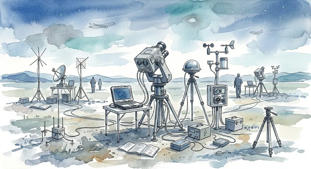
A UFO observation system must first notice events that cannot be scheduled in advance. Wide-field or all-sky cameras are suited to this role because they monitor a large fraction of the sky continuously rather than waiting for an operator to point a telescope towards an eyewitness report.
Visible-light cameras record approximately what a person would see. Infrared cameras detect radiation outside normal human vision and can continue to track some targets in darkness or against backgrounds where an ordinary camera has little contrast. Near-infrared and ultraviolet instruments can add further spectral bands. Comparing the same target across these channels can help distinguish a solid object from glare, a camera reflection or a source that is bright only within a particular wavelength range.
The Galileo Project, a research programme based at Harvard University, has proposed an observatory package in which wide-field cameras detect and track aerial objects, while narrower instruments examine selected targets in greater detail. Its design includes visible and infrared imaging, radar receivers, radio-frequency monitors, microphones and environmental instruments. The stated purpose is not merely to collect unusual photographs, but to conduct a long-term census of ordinary and unusual aerial activity so that possible anomalies can be assessed against a measured baseline.[Galileo Project]galileo.hsites.harvard.eduGalileo ProjectThe Scientific Investigation of Unidentified Aerial Phenomena (UAP) Using Multimodal Ground-Based Observatories | The Gali…
This baseline is essential. An algorithm cannot meaningfully label something an outlier until the system has learnt how aircraft, helicopters, drones, birds, insects, balloons, clouds, meteors and imaging faults appear under different conditions. A camera may produce thousands of apparently odd tracks simply because rain, heat, lens distortion or low contrast causes detection software to lose and reacquire an object.
That problem became clear during the commissioning of the Galileo Project’s eight-camera long-wave infrared array. Over five months, the system reconstructed roughly 500,000 aerial-object trajectories. An initial automated search flagged about 16 per cent as outliers according to a deliberately simple trajectory criterion. Manual review reduced the set to 144 ambiguous tracks, which the researchers considered likely to be mundane but could not classify confidently without distance information, improved kinematic measurements or corroboration from other sensor types. The exercise demonstrated why “unidentified” is often a statement about insufficient measurement rather than unusual physical performance.[MDPI]mdpi.comCommissioning an All-Sky Infrared Camera Array for Detection of Airborne ObjectsCommissioning an All-Sky Infrared Camera Array for Detection of Airborne ObjectsJanuary 28, 2025 — deficiency, the Galileo Project is…
The same study also illustrates the less glamorous work required before a UFO camera can produce defensible evidence. The infrared array was calibrated internally and against aircraft broadcasting Automatic Dependent Surveillance–Broadcast, or ADS-B, position data. Detection performance changed with weather, object size and range, and the average frame-by-frame detection efficiency for recorded aircraft was only 36 per cent during commissioning. A system that does not quantify such limitations may mistake its own missed detections or tracking errors for strange behaviour.[MDPI]mdpi.comCommissioning an All-Sky Infrared Camera Array for Detection of Airborne ObjectsCommissioning an All-Sky Infrared Camera Array for Detection of Airborne ObjectsJanuary 28, 2025 — deficiency, the Galileo Project is…
Radar, spectroscopy and environmental data
A camera normally measures the direction of an object, not its distance. That distinction matters because apparent speed depends on range. A nearby insect drifting across a lens, a balloon several kilometres away and a distant aircraft can produce similar angular movement despite having radically different sizes and velocities.
Radar can help by transmitting or receiving radio signals and using their timing, frequency shift or geometry to estimate range and motion. In a multi-sensor UFO observatory, radar measurements can be compared with an optical track: the camera provides appearance and angular position, while radar may supply distance and radial velocity. If both instruments independently follow the same target, investigators gain a much stronger basis for calculating its trajectory.
Radar is not infallible. Small objects may have weak radar returns, while buildings, terrain, weather, birds and electronic interference can produce clutter. Some systems filter out targets moving outside expected speed or altitude ranges, which means their apparent silence cannot automatically prove that an object was absent or technologically unusual. Conversely, a radar contact without a corresponding image may be a false detection or an object outside the camera’s sensitivity. The value comes from agreement among instruments whose weaknesses are different.
NASA’s independent UAP study stressed that much existing material lacks calibration, multiple measurements and essential metadata such as sensor type, observing mode, location and acquisition time. It suggested that established resources, including weather radar and Earth-observing instruments, may sometimes provide corroborating information or help rule out atmospheric explanations. NASA also cautioned that sensors designed for other purposes may introduce biases or omit the information needed for a conclusive reconstruction.[NASA]nasa.govuap independent study team final report 0Much like a team of peer reviewers, NASA commissions independent study teams as a formal part of NASA’s scientific process, and such team…
Spectroscopy addresses another question: what kind of light reached the instrument? Instead of recording only colour and brightness, a spectrometer separates light into wavelengths. Features within that spectrum may indicate reflected sunlight, thermal radiation, artificial lighting or emission from particular gases. In favourable circumstances, spectra can constrain temperature or composition, just as remote-sensing instruments use absorption and reflection patterns to identify terrestrial materials.[aviris.jpl.nasa.gov]aviris.jpl.nasa.govAVIRI SGreen plants, for example, use chlorophyll to absorb the visible light from the sun, but reflect the infrared radiation…
The limits are substantial. A small, fast target may not remain in a spectrometer’s narrow field of view long enough to produce a clean reading. Reflected sunlight can dominate the spectrum, and atmospheric absorption, cloud, distance and low signal strength can obscure useful features. Spectroscopy is therefore most effective when a wide-field detector automatically cues a tracking telescope or narrow-field instrument towards the target.
The Galileo Project’s proposed narrow-field package includes spectroscopy, photometry—the precise measurement of brightness—and polarimetry, which measures the orientation of light waves. Together, these could test whether an object’s brightness changes through rotation, whether its light resembles a known lamp or reflected source, and whether surface reflection or atmospheric scattering offers a plausible explanation. These measurements would narrow possibilities; they would not, on their own, establish an object’s origin.[Galileo Project]galileo.hsites.harvard.eduGalileo ProjectThe Scientific Investigation of Unidentified Aerial Phenomena (UAP) Using Multimodal Ground-Based Observatories | The Gali…
Environmental instruments provide the control data against which more dramatic claims must be judged. Useful measurements include wind speed and direction, temperature, pressure, humidity, precipitation and cloud cover. A slowly drifting object that matches local winds may be a balloon or lantern even when camera motion makes it appear fast. Clouds can intermittently hide an object, creating the impression that it vanished, entered water or divided into separate parts.
AARO’s 2025 reconstruction of the 2013 Aguadilla, Puerto Rico, infrared recording offers a concrete example. The video had been interpreted as showing a fast object splitting and entering the sea. By reconstructing the aircraft’s movement, sensor viewing direction, range changes, wind and cloud conditions, AARO concluded that two objects remained over land and moved approximately with the wind. Motion parallax—the apparent movement created by the observing aircraft’s own path—and intermittent thermal visibility accounted for much of the extraordinary appearance.[AARO]aaro.milOpen source on aaro.mil.
Magnetometers, radio-spectrum analysers, acoustic sensors and particle detectors can be included to investigate reports of electromagnetic interference, unusual sounds or local radiation changes. These channels require especially careful controls because natural fluctuations, nearby equipment, vehicles, power lines and distant transmitters can generate apparent anomalies. A magnetic deviation becomes potentially relevant only when it is accurately timed, localised, compared with a reference station and correlated with an independently tracked aerial object.
A Galileo Project team has deployed a calibrated magnetic variometer near Boulder, Colorado, comparing its readings with a United States Geological Survey observatory. The work demonstrates the correct order of operations: establish that the instrument performs reliably and records known geomagnetic events before interpreting unexplained changes alongside camera or acoustic detections. No magnetic fluctuation should be attributed to a UFO merely because it occurred during a period of public interest or eyewitness activity.[arXiv]arxiv.orgOpen source on arxiv.org.
Triangulation across multiple stations
The most important improvement over a single camera is observing the same object from separated locations. Each station records a line of sight. Where those lines intersect, investigators can estimate a three-dimensional position. Repeating the calculation across successive frames produces velocity and acceleration rather than an impression of movement on a flat screen.
This method, known as triangulation or stereoscopic localisation, directly addresses several common UFO ambiguities. It can distinguish a small nearby object from a large distant one, test claims of extreme speed and show whether an apparent turn reflects genuine motion or merely a changing viewing angle. A proposed Galileo Project localisation platform uses weatherproof visible, near-infrared and infrared cameras, calibrated so that observations over time can be converted into three-dimensional positions and then into estimates of speed and acceleration.[arXiv]arxiv.orgarXiv A Hardware and Software Platform for Aerial Object LocalizationarXiv A Hardware and Software Platform for Aerial Object Localization
Meteor astronomy demonstrates that this is an established technique rather than a UFO-specific invention. Networks such as the Global Meteor Network combine time-stamped observations from separated cameras to calculate atmospheric trajectories and, in suitable cases, pre-entry orbits. Events seen by only one station may be rejected from trajectory analysis because a single line of sight cannot supply the required geometry. Regular recalibration against stars helps correct camera pointing and lens distortion.[doi.org]doi.orgOpen source on doi.org.
For UFO research, station placement involves a trade-off. If cameras are too close together, their lines of sight provide little parallax for distant objects, making range uncertain. If they are too far apart, low-altitude or short-lived events may not fall within overlapping fields of view. Terrain, buildings, cloud patterns, radio interference and access for maintenance also affect site choice.
Accurate timing is equally important. A fast target recorded by cameras whose clocks differ by even a fraction of a second may appear to occupy incompatible positions. Each station therefore needs a stable time source, recorded clock uncertainty and a common data format. Calibration files, weather readings, exposure settings and software versions must be preserved alongside the imagery.
An effective network would follow a sequence such as this:

- Wide-field instruments at one or more stations detect and track a moving source.
- Synchronous visible and infrared recordings establish whether it appears in multiple spectral bands.
- A second station confirms the event and supplies parallax for range estimation.
- Radar or passive radio measurements are matched to the optical trajectory where possible.
- Narrow-field cameras and spectrometers are directed towards the object.
- ADS-B records, satellite predictions, drone information and weather data are checked for conventional matches.
- The system stores raw data, calibration records and metadata before automated processing.
- Analysts test ordinary explanations before classifying an event as unresolved.
The final step is crucial. Machine-learning software can identify objects and rank unusual tracks, but an anomaly score is not a finding of exotic technology. Algorithms are shaped by their training data and may flag rare camera faults, unusual aircraft attitudes or poorly represented weather conditions. The Galileo Project’s infrared commissioning results showed how a large automated outlier set can shrink sharply after review, while still leaving cases that cannot be resolved because a crucial variable—particularly distance—is absent.[MDPI]mdpi.comCommissioning an All-Sky Infrared Camera Array for Detection of Airborne ObjectsCommissioning an All-Sky Infrared Camera Array for Detection of Airborne ObjectsJanuary 28, 2025 — deficiency, the Galileo Project is…
What would count as a strong UFO measurement?
A scientifically significant event would need more than several devices producing unexplained marks. The detections should be demonstrably linked to the same object, recorded with known uncertainties and inconsistent with plausible conventional explanations.
The strongest record would contain:
- simultaneous observations from geographically separated stations;
- precise timestamps and documented sensor locations;
- calibrated visible and infrared imagery;
- a triangulated three-dimensional path;
- independent radar-derived range or velocity;
- spectral or photometric measurements with adequate signal quality;
- local weather and atmospheric data;
- air-traffic, drone and satellite comparisons;
- preserved raw files and full sensor metadata;
- analysis that can be reproduced by independent researchers.
Agreement matters more than the sheer number of sensors. Four poorly synchronised cameras do not automatically provide four independent confirmations. Instruments may share the same obstruction, software error or mistaken target association. Investigators must show that the radar return, optical image and infrared track overlap within their measured uncertainties.
Contradictions are informative as well. An object visible to one camera but absent from a nearby instrument may fall outside the second camera’s wavelength range or sensitivity; it may also be a reflection, internal lens artefact or nearby object. A bright visual source with no radar return might be a distant light, a small low-reflectivity object or a phenomenon without a solid radar-reflecting surface. Multi-sensor research does not eliminate ambiguity, but it makes the location of that ambiguity explicit.
The chief scientific payoff may therefore be less dramatic than proving or disproving extraterrestrial visitation. A well-designed network can show when an apparent high-speed manoeuvre is caused by parallax, when a disappearance coincides with cloud cover, when an infrared shape results from sensor processing, or when an unusual light follows an ordinary aircraft or satellite path. It can also identify the rarer cases in which measured position, motion or spectral properties genuinely resist classification.
Within the wider culture of celebrity UFO accounts, this changes the role of testimony. A famous witness may alert investigators, reduce reporting stigma or provide an approximate time and direction. The decisive evidence, however, would come from instruments that were already operating, calibrated and synchronised before the sighting occurred. A recognisable name can draw attention to an event; only a reproducible chain of measurements can establish what physically happened.

Amazon book picks
Further Reading
Books and field guides related to How Scientists Could Measure a UFO Sighting. Use these as the next step if you want deeper reading beyond the article.
The UFO Experience: A Scientific Inquiry
Cited by the New York Review of Books as "the best brief for visitation," this classic study presents an analysis of UFO reports and conc...
UFOs: Generals, Pilots, and Government Officials Go on the Re...
NEW YORK TIMES BESTSELLER • Impeccably researched, this riveting journalistic investigation separates fact from fiction, and documents th...
How to Lie with Maps
An updated edition of the "humorous, informative and perceptive" guide to how maps can lead us astray ( Toronto Globe and Mail). An insta...
The Demon-Haunted World: Science as a Candle in the Dark
Are we on the brink of a new Dark Age of irrationality and superstition? In this book, the writer shows how scientific thinking is necess...
eBay marketplace picks
Marketplace Samples
Live-tested eBay searches with available results related to this page.
Selected fromUFO poster oneBay.co.uk.



Endnotes
1.
Source: galileo.hsites.harvard.edu
Link:https://galileo.hsites.harvard.edu/publications/scientific-investigation-unidentified-aerial-phenomena-uap-using-multimodal
Source snippet
Galileo ProjectThe Scientific Investigation of Unidentified Aerial Phenomena (UAP) Using Multimodal Ground-Based Observatories | The Gali...
2.
Source: mdpi.com
Title: Commissioning an All-Sky Infrared Camera Array for Detection of Airborne Objects
Link:https://www.mdpi.com/1424-8220/25/3/783
Source snippet
Commissioning an All-Sky Infrared Camera Array for Detection of Airborne ObjectsJanuary 28, 2025 — deficiency, the Galileo Project is...
Published: January 28, 2025
3.
Source: arxiv.org
Link:https://arxiv.org/abs/2411.07956
4.
Source: nasa.gov
Title: uap independent study team final report 0
Link:https://www.nasa.gov/wp-content/uploads/2023/09/uap-independent-study-team-final-report-0.pdf?emrc=69d6ab074102b
Source snippet
Much like a team of peer reviewers, NASA commissions independent study teams as a formal part of NASA’s scientific process, and such team...
5.
Source: nasa.gov
Title: UPDATE: NASA Shares UAP Independent Study Report; Names Director
Link:https://www.nasa.gov/news-release/update-nasa-shares-uap-independent-study-report-names-director/
Source snippet
We found that NASA can help the whole-of-government UAP effort through systematic data calibration, multiple measurements and ensuring th...
6.
Source: aviris.jpl.nasa.gov
Title: AVIRI S
Link:https://aviris.jpl.nasa.gov/aviris/spectrum.html
Source snippet
Green plants, for example, use chlorophyll to absorb the visible light from the sun, but reflect the infrared radiation...
7.
Source: science.nasa.gov
Title: Science Remote Sensing
Link:https://science.nasa.gov/earth/earth-observatory/remote-sensing/
Source snippet
In a similar manner, certain satellite sensors can record reflected energy in the red, green, blue, or infrared bands of the spectrum, a...
8.
Source: [aaro]({{ ‘aaro/’ | relative_url }}). mil
Link:https://www.aaro.mil/Portals/136/PDFs/case_resolution_reports/AARO_Puerto_Rico_UAP_Case_Resolution.pdf
9.
Source: aaro.mil
Link:https://www.aaro.mil/Portals/136/PDFs/SASC_AARO_Open_Hearing_Case_Slides_19Nov2024.pdf
10.
Source: arxiv.org
Link:https://arxiv.org/abs/2507.11355
11.
Source: arxiv.org
Title: arXiv A Hardware and Software Platform for Aerial Object Localization
Link:https://arxiv.org/abs/2305.18555
12.
Source: doi.org
Link:https://doi.org/10.1093/mnras/stab2008
13.
Source: academic.oup.com
Link:https://academic.oup.com/mnras/article/506/4/5046/6347233
14.
Source: academic.oup.com
Link:https://academic.oup.com/mnras/article-abstract/506/4/5046/6347233
15.
Source: arxiv.org
Link:https://arxiv.org/abs/2506.00125
16.
Source: aaro.mil
Link:https://www.aaro.mil/Next-AARO-Home-redesign/Next-Parent/Next-UAP-Report-Documents/
17.
Source: science.nasa.gov
Title: hubble spectroscopy
Link:https://science.nasa.gov/mission/hubble/science/science-behind-the-discoveries/hubble-spectroscopy/
18.
Source: science.nasa.gov
Link:https://science.nasa.gov/science-research/earth-science/joint-earth-observation-mission-quality-assessment-framework-optical-guidelines-documents-released/
19.
Source: science.nasa.gov
Link:https://science.nasa.gov/uap/faqs/
20.
Source: science.nasa.gov
Link:https://science.nasa.gov/uap/
21.
Source: aaro.mil
Link:https://www.aaro.mil/Next-AARO-Home-redesign/Next-Parent/Presidential-UAP-Transparency-Initiative/
22.
Source: aaro.mil
Link:https://www.aaro.mil/Next-AARO-Home-redesign/Next-Parent/Next-AARO-UAP-Imagery-Fixed-Table/
23.
Source: mdpi.com
Title: Optical FBG Sensor-Based System for Low-Flying UAV Detection and Localization
Link:https://www.mdpi.com/2076-3417/15/21/11690
24.
Source: aaro.mil
Title: AAR O UAP Case RR Data Table
Link:https://www.aaro.mil/Next-AARO-Home-redesign/Next-Parent/Next-UAP-Case-RR-Data-Table/
25.
Source: science.nasa.gov
Title: spectroscopy 101 types of spectra and spectroscopy
Link:https://science.nasa.gov/mission/webb/science-overview/science-explainers/spectroscopy-101-types-of-spectra-and-spectroscopy/
26.
Source: aaro.mil
Title: Mt. Etna Object
Link:https://www.aaro.mil/Portals/136/PDFs/case_resolution_reports/Mt-Etna-Object.pdf
27.
Source: arxiv.org
Link:https://arxiv.org/abs/2411.07956v2
28.
Source: galileo.hsites.harvard.edu
Title: gp 2024 dalek commissioning paper full
Link:https://galileo.hsites.harvard.edu/sites/g/files/omnuum6371/files/gp_2024_dalek_commissioning_paper_full.pdf
29.
Source: ntrs.nasa.gov
Link:https://ntrs.nasa.gov/citations/20240007008
30.
Source: aaro.mil
Title: Eglin UAP Case Resolution
Link:https://www.aaro.mil/Portals/136/PDFs/case_resolution_reports/Case_Resolution_of_Eglin_UAP_2508.pdf
31.
Source: aaro.mil
Link:https://www.aaro.mil/Next-AARO-Home-redesign/Next-Parent/Presidential-UAP-Transparency-Initiative/videoid/1007707/dvpcc/false/
32.
Source: aaro.mil
Title: All-domain Anomaly Resolution Office
Link:https://www.aaro.mil/Portals/136/PDFs/case_resolution_reports/Case_Resolution_of_Western_United_States_Uap_508-02262024.pdf
33.
Source: aaro.mil
Link:https://www.aaro.mil/Next-AARO-Home-redesign/Next-Parent/Presidential-UAP-Transparency-Initiative/videoid/988676/dvpcc/false/
34.
Source: nasa.gov
Title: uap independent study team final report 0
Link:https://www.nasa.gov/wp-content/uploads/2023/09/uap-independent-study-team-final-report-0.pdf?emrc=69e0da8529f66
35.
Source: nasa.gov
Title: uap independent study team final report 0
Link:https://www.nasa.gov/wp-content/uploads/2023/09/uap-independent-study-team-final-report-0.pdf?emrc=6a009cf0822bc
36.
Source: nasa.gov
Title: uap independent study team final report 0
Link:https://www.nasa.gov/wp-content/uploads/2023/09/uap-independent-study-team-final-report-0.pdf?emrc=6a56289587df4
37.
Source: nasa.gov
Title: uap independent study team final report 0
Link:https://www.nasa.gov/wp-content/uploads/2023/09/uap-independent-study-team-final-report-0.pdf?emrc=69fb208d27af8
38.
Source: nasa.gov
Title: uap independent study team final report 0
Link:https://www.nasa.gov/wp-content/uploads/2023/09/uap-independent-study-team-final-report-0.pdf?emrc=69d3785d47141
39.
Source: nasa.gov
Title: uap independent study team final report 0
Link:https://www.nasa.gov/wp-content/uploads/2023/09/uap-independent-study-team-final-report-0.pdf?emrc=6a5b6fd775399
40.
Source: nasa.gov
Title: uap independent study team final report 0
Link:https://www.nasa.gov/wp-content/uploads/2023/09/uap-independent-study-team-final-report-0.pdf?emrc=69e1b947327d6
41.
Source: nasa.gov
Title: uap independent study team final report 0
Link:https://www.nasa.gov/wp-content/uploads/2023/09/uap-independent-study-team-final-report-0.pdf?emrc=6a4597555b721
42.
Source: nasa.gov
Title: uap independent study team final report 0
Link:https://www.nasa.gov/wp-content/uploads/2023/09/uap-independent-study-team-final-report-0.pdf?emrc=6a6167cfe42dd
43.
Source: nasa.gov
Title: uap independent study team final report 0
Link:https://www.nasa.gov/wp-content/uploads/2023/09/uap-independent-study-team-final-report-0.pdf?emrc=661a8510ae608
44.
Source: nasa.gov
Title: uap independent study team final report 0
Link:https://www.nasa.gov/wp-content/uploads/2023/09/uap-independent-study-team-final-report-0.pdf?emrc=69de7b270f4c0
45.
Source: nasa.gov
Title: NAS A to Release, Discuss Unidentified Anomalous Phenomena Report
Link:https://www.nasa.gov/news-release/nasa-to-release-discuss-unidentified-anomalous-phenomena-report/
46.
Source: galileo.hsites.harvard.edu
Link:https://galileo.hsites.harvard.edu/resource/s2251171723400081pdf
47.
Source: arxiv.org
Link:https://arxiv.org/abs/2305.18555v1
48.
Source: galileo.hsites.harvard.edu
Title: pdf download
Link:https://galileo.hsites.harvard.edu/resource/pdf-download
49.
Source: galileo.hsites.harvard.edu
Title: pdf download 0
Link:https://galileo.hsites.harvard.edu/resource/pdf-download-0
50.
Source: nasa.gov
Title: NAS A Announces Unidentified Aerial Phenomena Study Team Members
Link:https://www.nasa.gov/general/nasa-announces-unidentified-aerial-phenomena-study-team-members/
51.
Source: galileo.hsites.harvard.edu
Link:https://galileo.hsites.harvard.edu/FAQ
52.
Source: ntrs.nasa.gov
Link:https://ntrs.nasa.gov/citations/20210025560
53.
Source: science.nasa.gov
Title: how to interpret a false color satellite image
Link:https://science.nasa.gov/earth/earth-observatory/how-to-interpret-a-false-color-satellite-image/
54.
Source: ntrs.nasa.gov
Link:https://ntrs.nasa.gov/citations/20120014236
55.
Source: aaro.mil
Link:https://www.aaro.mil/Next-AARO-Home-redesign/Bruce-working/Next-AARO-UAP-Trends-Charts/
56.
Source: aviris.jpl.nasa.gov
Title: imaging spectroscopy
Link:https://aviris.jpl.nasa.gov/aviris/imaging_spectroscopy.html
57.
Source: galileo.hsites.harvard.edu
Title: hardware and software platform aerial object localization
Link:https://galileo.hsites.harvard.edu/publications/hardware-and-software-platform-aerial-object-localization
58.
Source: galileo.hsites.harvard.edu
Title: integrated computing platform detection and tracking unidentified aerial
Link:https://galileo.hsites.harvard.edu/publications/integrated-computing-platform-detection-and-tracking-unidentified-aerial
59.
Source: galileo.hsites.harvard.edu
Link:https://galileo.hsites.harvard.edu/search
60.
Source: galileo.hsites.harvard.edu
Link:https://galileo.hsites.harvard.edu/publications
61.
Source: galileo.hsites.harvard.edu
Title: commissioning all sky infrared camera array detection airborne objects
Link:https://galileo.hsites.harvard.edu/publication/commissioning-all-sky-infrared-camera-array-detection-airborne-objects
62.
Source: galileo.hsites.harvard.edu
Link:https://galileo.hsites.harvard.edu/publication/deployment-geomagnetic-variometer-station-auxiliary-instrumentation-study-unidentified
63.
Source: galileo.hsites.harvard.edu
Link:https://galileo.hsites.harvard.edu/resource/wattersetalgpuapinvestigation2023preprintpdf
64.
Source: galileo.hsites.harvard.edu
Link:https://galileo.hsites.harvard.edu/scope
65.
Source: aaro.mil
Link:https://www.aaro.mil/Next-AARO-Home-redesign/Inactive-Parent/Next-UAP-Imagery-dup/
66.
Source: aaro.mil
Link:https://www.aaro.mil/
67.
Source: aaro.mil
Link:https://www.aaro.mil/UAP-Cases/UAP-Case-Resolution-Reports/
68.
Source: aaro.mil
Link:https://www.aaro.mil/Next-AARO-Home-redesign/Next-Parent/AARO-UAP-Case-Resolution-DT/
69.
Source: ar5iv.labs.arxiv.org
Link:https://ar5iv.labs.arxiv.org/html/2411.07956
70.
Source: youtube.com
Title: Analyzing Unidentified Aerial Phenomena
Link:https://www.youtube.com/watch?v=yADLnhfvVg4
Source snippet
Galileo Project multi sensor observatory UAP Avi Loeb Episode 3: The Galileo Project: Can Science Finally Detect UFOs? | Prof. Avi Loeb...
71.
Source: thedebrief.org
Link:https://thedebrief.org/galileo-project-releases-commissioning-data-on-half-a-million-aerial-objects-are-any-of-them-uap/
72.
Source: emeteornews.net
Title: Global Meteor Network | e Met N Meteor Journal
Link:https://www.emeteornews.net/global-meteor-network/
73.
Source: explorescu.org
Link:https://www.explorescu.org/team
Additional References
74.
Source: youtube.com
Link:https://www.youtube.com/watch?v=mvsU4p0Gsas
Source snippet
UFOs & UAPs: The Situation Has Changed! Avi Loeb and Harvard’s Galileo Project...
75.
Source: youtube.com
Title: UFOs & UAPs: The Situation Has Changed! Avi Loeb and Harvard’s Galileo Project
Link:https://www.youtube.com/watch?v=N9lUceHsLRw
Source snippet
Public Meeting on Unidentified Anomalous Phenomena (Official NASA Broadcast)...
76.
Source: youtube.com
Title: Public Meeting on Unidentified Anomalous Phenomena (Official NASA Broadcast)
Link:https://www.youtube.com/watch?v=bQo08JRY0iM
Source snippet
Unidentified Anomalous Phenomena Independent Study Report...
77.
Source: uap-archive.org
Link:https://uap-archive.org/uap/records/aaro-historical-record-report-vol1/
78.
Source: rr0.org
Link:https://rr0.org/time/2/0/2/4/04/Mellon_PentagonNewUapReportSeriouslyFlawed_TheDebrief/14/
79.
Source: explorescu.org
Link:https://www.explorescu.org/about-us
80.
Source: uapexpedition.org
Link:https://www.uapexpedition.org/affiliates
81.
Source: seti.org
Link:https://www.seti.org/projects/cams/
82.
Source: papers.cool
Link:https://papers.cool/arxiv/2411.07956
83.
Source: sciencedirect.com
Link:https://www.sciencedirect.com/science/article/pii/S1270963825015184